SPECIAL AREA OF CONSERVATION
THE PEAT ON WALSHAW MOOR
By Walshaw Turbines Research Group and Forus Tree
Walshaw Moor is an internationally designated Special Area of Conservation (SAC) mainly as a peatland. Peat is plant material that has decayed in wet conditions so the carbon cannot oxidise. Peatlands store more carbon that all the rest of the world’s vegetation put together. An active bog forms new peat at about 1 mm per year, taking CO2 out of the atmosphere and locking away the carbon. Natural England and the Walshaw Moor Estate have an agreement, running from 2018-2042 to increase the extent and quality of active bog.
The peat inside the Calderdale Energy Park boundary is up to six metres deep, with an average depth of one metre. When peat is disturbed it dries out and the stored carbon oxidises back to CO2.
Wind farms should not be built on peat because they are likely to release more CO2 than they will ever save. As more of the UK’s electricity is generated by renewables, the amount of CO2 a wind farm saves goes down because less fossil fuel is being burned. A wind farm on peat releases a huge amount of CO2 as it is built and continuous plume of CO2 as the onsite peat dries and oxidises. Wind farms on other soil types only emit a minute proportion of CO2 when disturbed compared to what happens with peat. It is urgent that we rewet all our peatlands and not dry them out with wind farms. A tipping point causing accelerated CO2 release occurs when peat fires become endemic at our latitude. The UK can lead on peat restoration, which is inexpensive and has many other benefits for water supply and nature recovery.
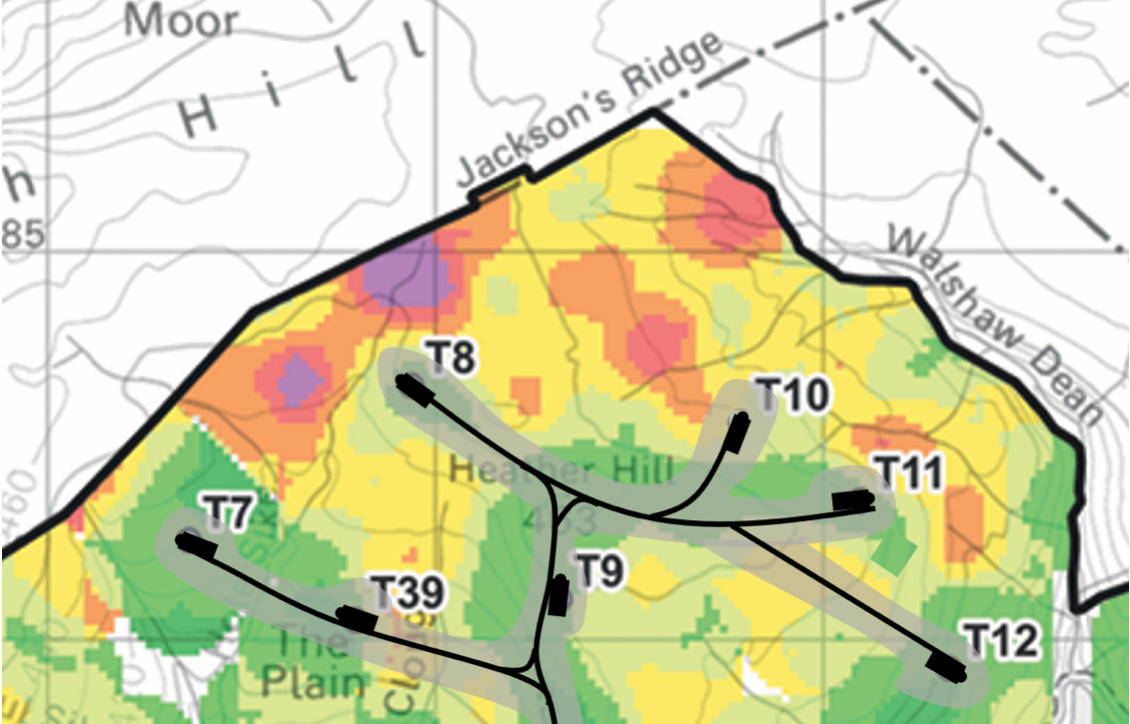
Peat is destroyed by CEP in two ways. The first is by the direct digging of turbine foundations, crane hardstandings, access tracks and compounds. The second is by the drying of peat around all the infrastructure, because all of it has drainage ditches and the tracks themselves act as drains. This drying effect takes place for the whole lifetime of CEP, and beyond, because the infrastructure will never be removed. The destruction of peat by drainage occurs in a margin around the infrastructure of up to 400 metres, depending on the slope and peat depth. It is common to use a 50-metre margin and this has been used by the CEP developers in their maps of access tracks across moorland.
The map shows a section of CEP. The immediate peat destruction by the tracks, foundations and crane hardstandings, is shown in black, to scale. The destruction by drying in a 50-metre margin is shown in grey. NW of T7 is an area where the drying effect would extend well beyond the 50-metre margin because of the steep ground that funnels into the drained grey area. The track to T12 on a very steep edge would act as a storm drain and increase the run-off rate from the plateau into the reservoirs and then to Hebden Bridge. T10 and T11 have a similar effect. The map shows why degradation by drying causes more CO2 release and global warming than the immediate release during construction. There is an explanation of the peat depth map here.


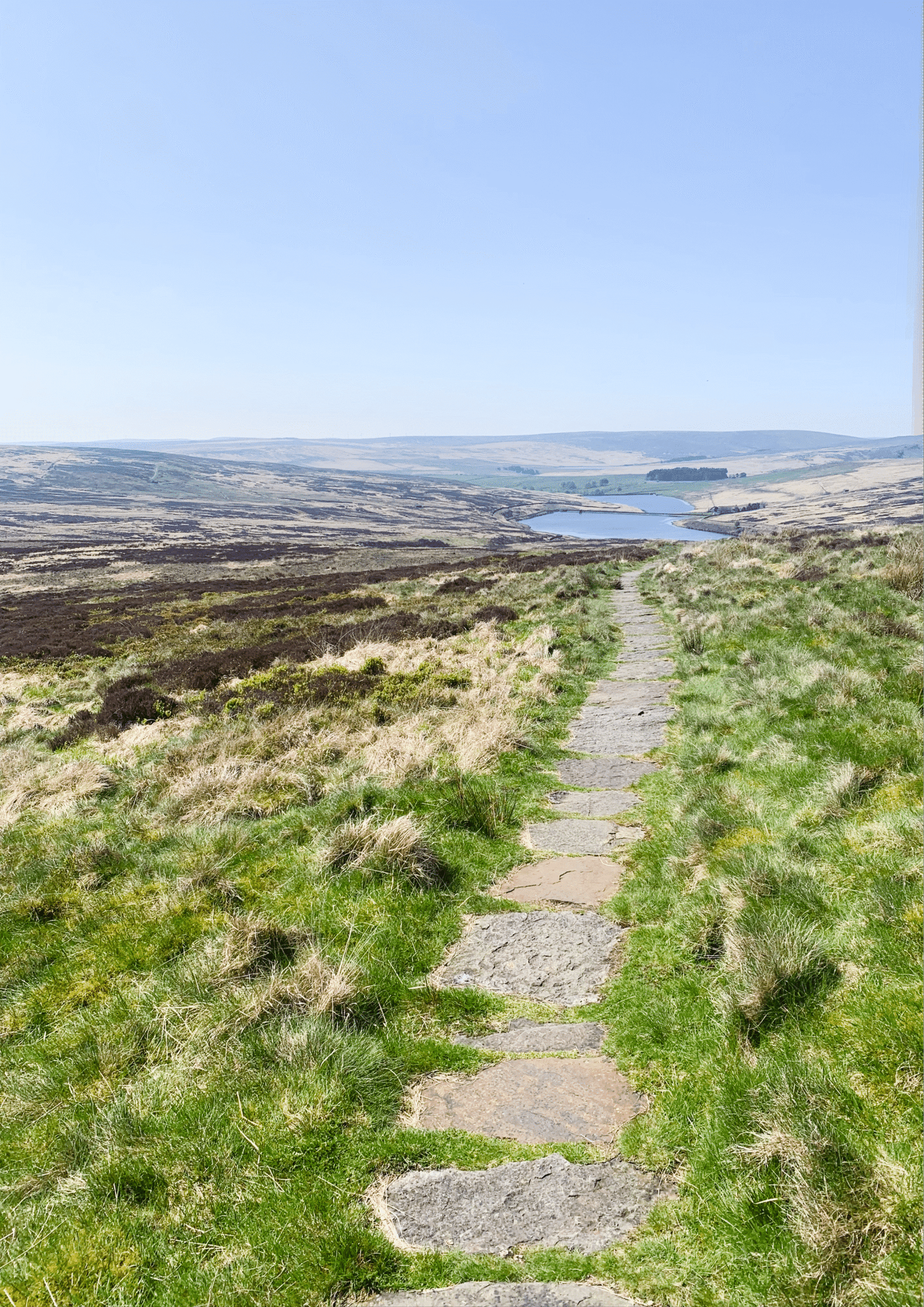
The image above envisions how the site will appear from Cock Hill on Oxenhope Moor.
How You Can Help
GETTING INVOLVED
Speak Out
Share your thoughts with your communities at home and online. Attend meetings.
Contact a member of the House of Lords.
Write to the Secretary of State for Energy Security and Net Zero, (currently Ed Miliband), Secretary.State@energysecurity.gov.uk and tell them that there is no need to build wind farms on protected peatland.
Stronger Together
You are welcome to join our campaign group and add your voice and vote to the many – The Calderdale Windfarm Action Group is the main Facebook group representing all of the eight campaign groups of Stronger Together to Stop Calderdale Windfarm.
We’d love to have you on board with us.


Media Enquiries
For interviews and press/media enquiries please contact:
Lydia MacKinnon - 07766 333114
Penny Price - 07771 737274


