ACCESS OPTION A TO CALDERDALE ENERGY PARK
we’ll follow the option a turbine blade delivery route from the M62 and through halifax.
By Walshaw Turbines Research Group
The most likely turbine for CEP is the Vestas 162-7.2 MW. The rotor diameter is 162 metres and the blades are 80-metres long. To date the only similar blade delivery in the UK and Ireland is by Collett & Sons of Halifax to Cushaling wind farm in Kildare, Ireland which was for nine Vestas 162-6.2 MW turbines. Collett is one of the most innovative transport companies in Europe with an immensely skilled work force.
The blades will either be delivered flat all the way, or transferred to a trailer that can raise the blades to 65 degrees and pass pinchpoints that would otherwise need a lot of engineering work. We shall follow a flat delivery to see if raised blades are needed, which is a very different process, disruptive to communities, and rarely used.
A flat delivery is shown in the photo. The blade is clamped to the trailer and to a dolly near the back. The blade can swiwel at the lorry end and the dolly can swivel under the tail. The whole assembly is 93 metres long and 11 metres of blade protrudes beyond the dolly.
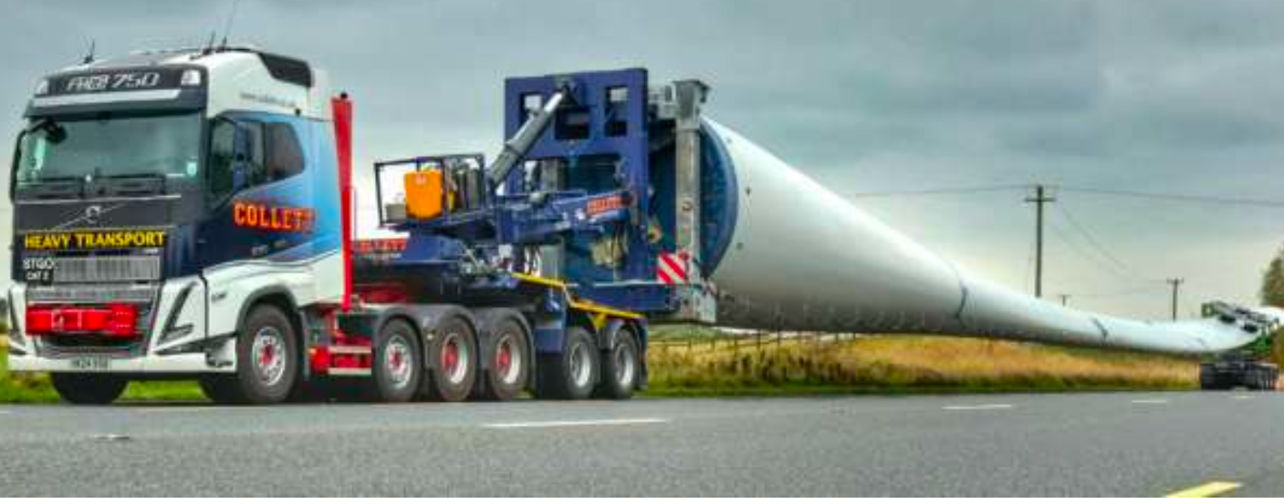
80-metre blade being delivered to Cushaling WF | Photo: Collett
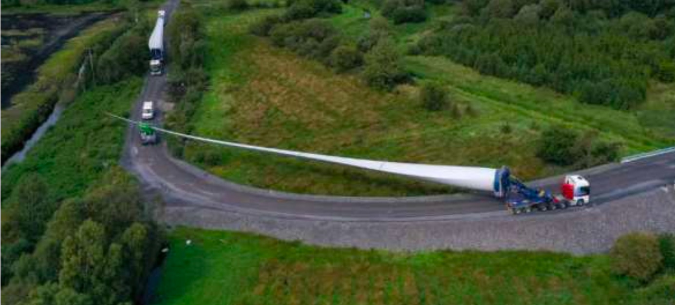
Clearance allows corners to be cut | Photo Collett
Temporary tracks were built across roundabouts and deliveries through towns were done at night. The blades were delivered all the way to the turbine pad.
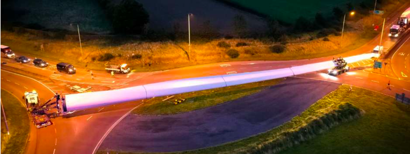
Roundabout crossing by night | Photo: Collett
We shall make “swept path” diagrams that show the path of the blade in tight places. In the swept path diagrams we shall use this model of the system, with the red sections able to swivel relative to the yellow blade. The usual one-metre clearance is shown round the blade.

Blade diagram for swept path analysis | Diagram: WTRG
Access Option A of Calderdale Energy Park begins at Goole port. We follow the delivery route south to north from J24 on the M62 to Cock Hill compound. First we come off the M62 on the narrow slip road to loop round under the motorway on the A629.
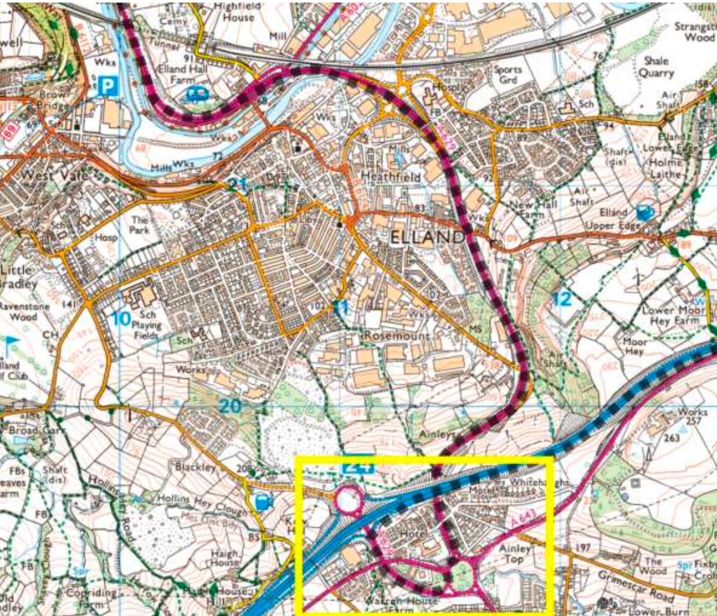
Option A leaves M62 at J24 and follows the dotted line under the motorway | Map: WTRG
The slip road at J24 makes a right-angle bend to join the A629. The vegetation on the bend would be cut back so the blade can cut the corner. The streetlights would be temporarily removed. Gardening and removal of street furniture is normal in blade delivery.
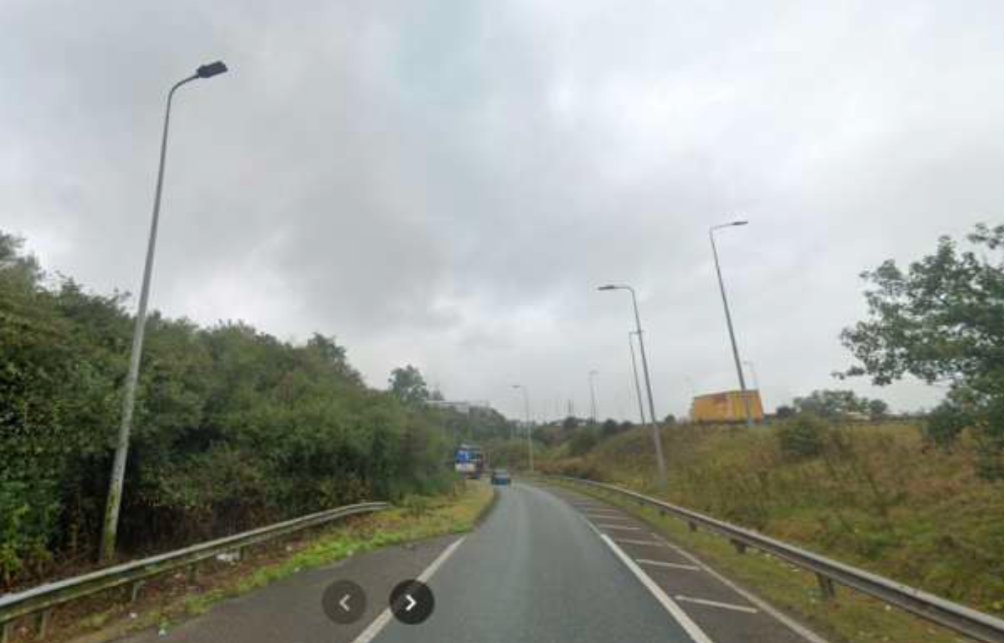
The J24 slip road is narrow with a tight bend | Photo: Streetview
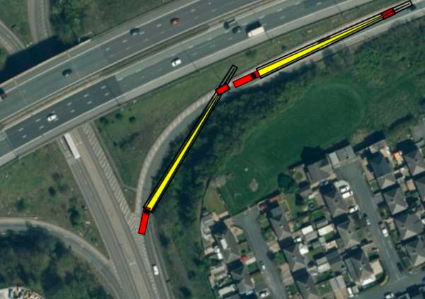
The swept path of the blade on the slip road cuts the corner | Diagram: WTRG
The roundabout is straightforward after some gardening.
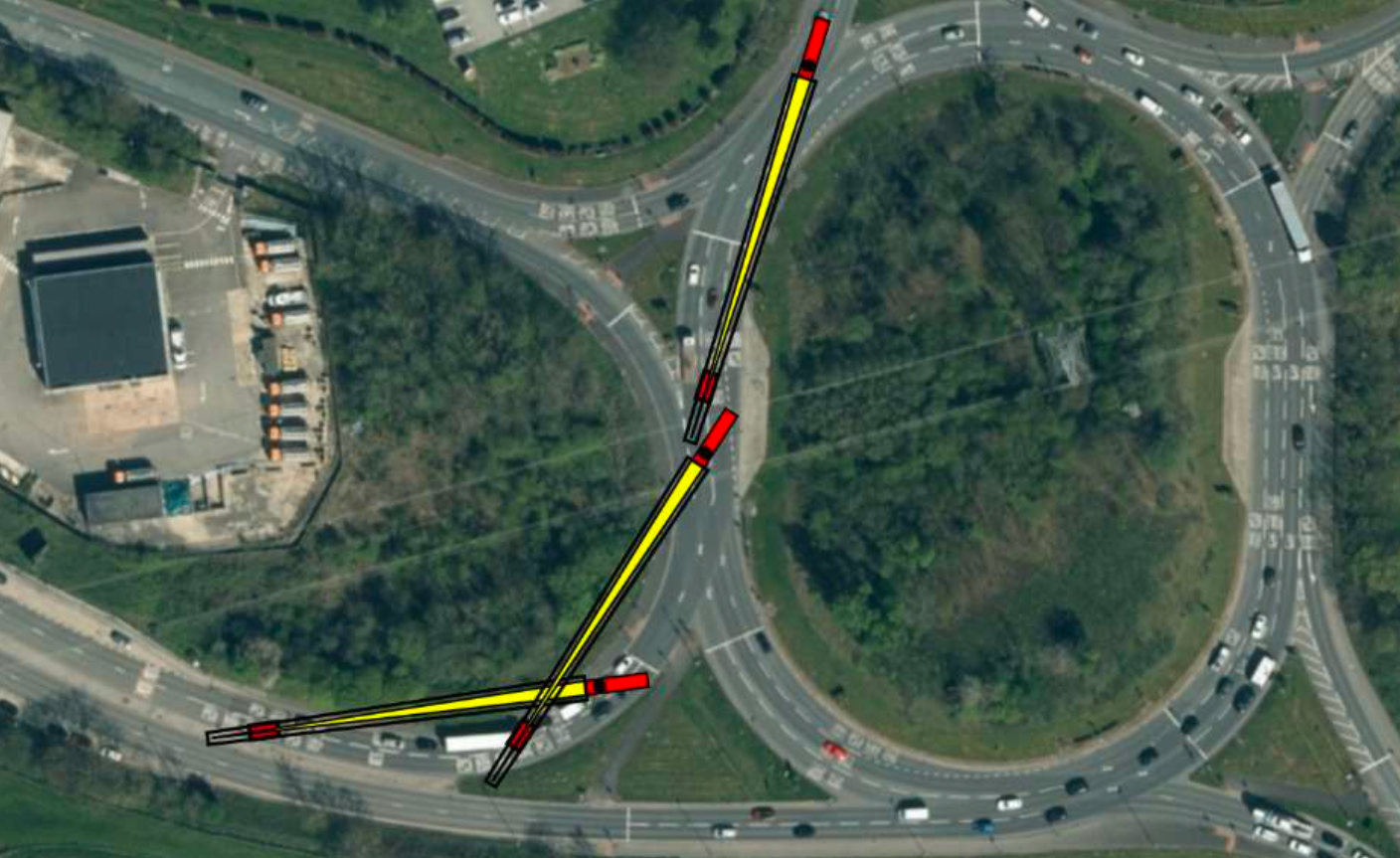
Swept path diagram for the roundabout at J24 of M62 | Diagram: WTRG
The A629 continues into Halifax and the next difficulty is round Salterhebble.
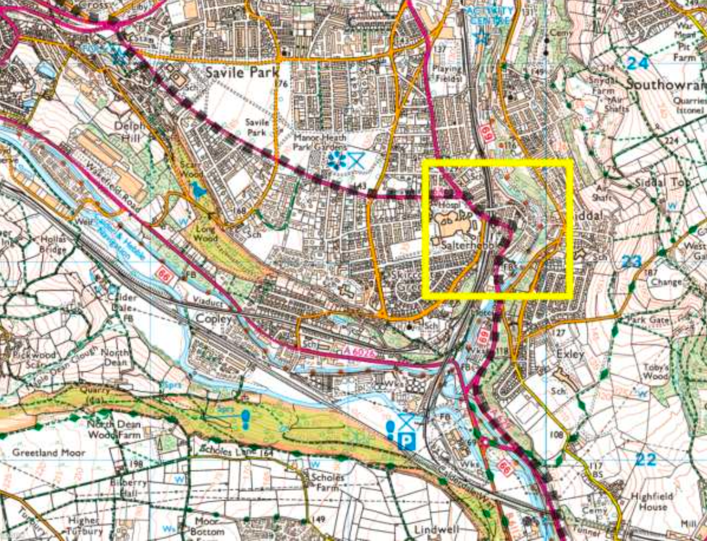
The A629 into Halifax passes Salterhebble bend | Map: WTRG
The deliveries would be at night and would need all four lanes and the hard shoulders.
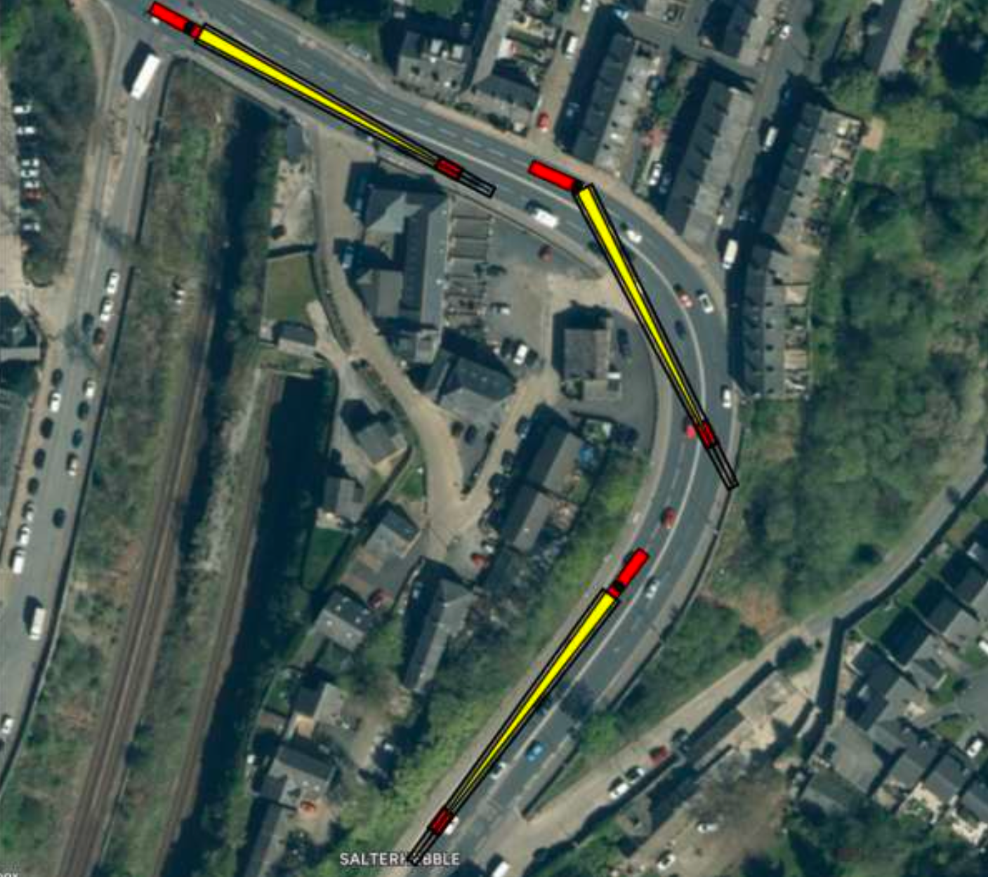
The swept path around Salterhebble bend shows all four lanes are required | Diagram: WTRG
The route goes easily past Savile Park before the main difficulties into and out of Spring Hall Lane.
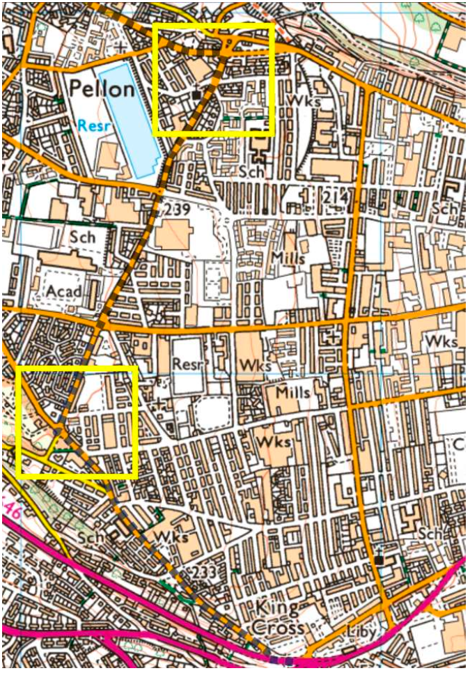
The two hard turns at either end of Spring Hall Lane in Halifax | Map: WTRG
Turning into Spring Hall Lane the blades would have to sweep across the park shown below. Plane trees are characteristic of this area in Halifax.

Public park with community orchard and four plane trees that would be felled | Photo: WTRG

Swept path into the park shows need to fell all the trees | Diagram: WTRG
This turn wil require the felling the four trees. A temporary track would be built for the path of the dolly as it makes its arc beyond the trees. Some of the newly planted community orchard trees may survive the oversail and dolly track.
The destruction of the trees and community orchard could be avoided if blade raising technology were used as it was in Hawick. We have to decide between the profit of CWF Ltd and the environment of a deprived part of Halifax. The delivery implications of raised blades will be discussed at the end.
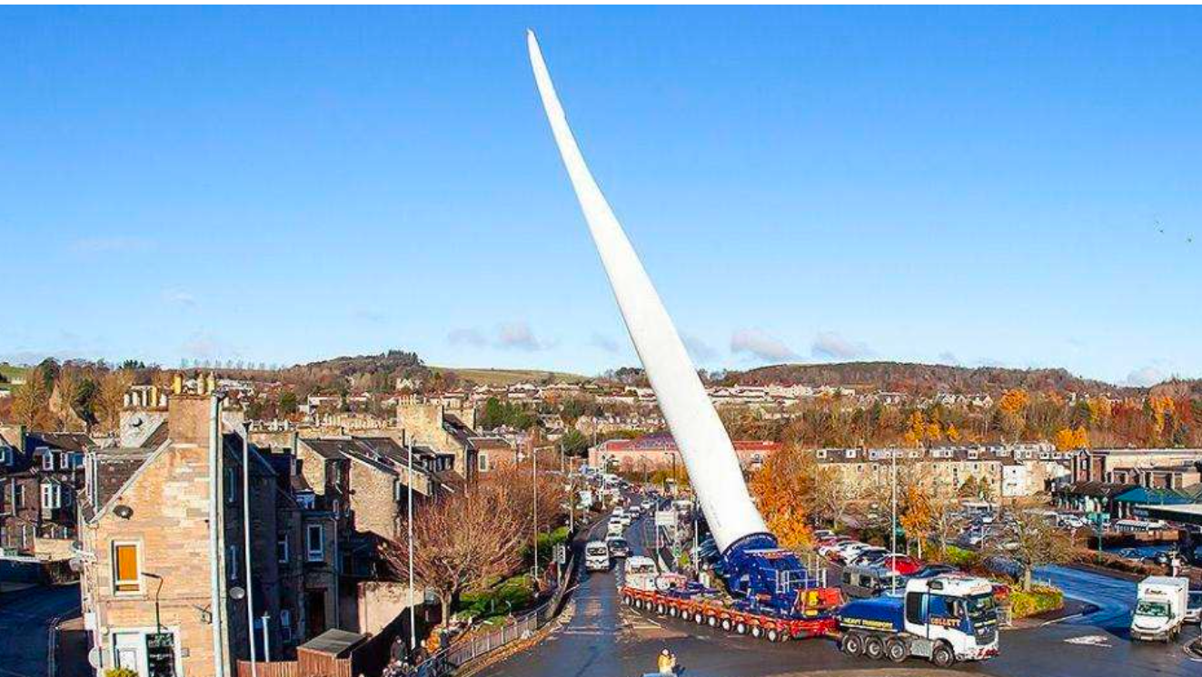
Raised 65-metre blade through Hawick | Photo: BBC
The turn out of Spring Hall Lane into Moor End Road would require the demolition of the car dealership building inside the apex. This can also be avoided if raised blades are used.

This car dealership must be demolished | Photo: WTRG
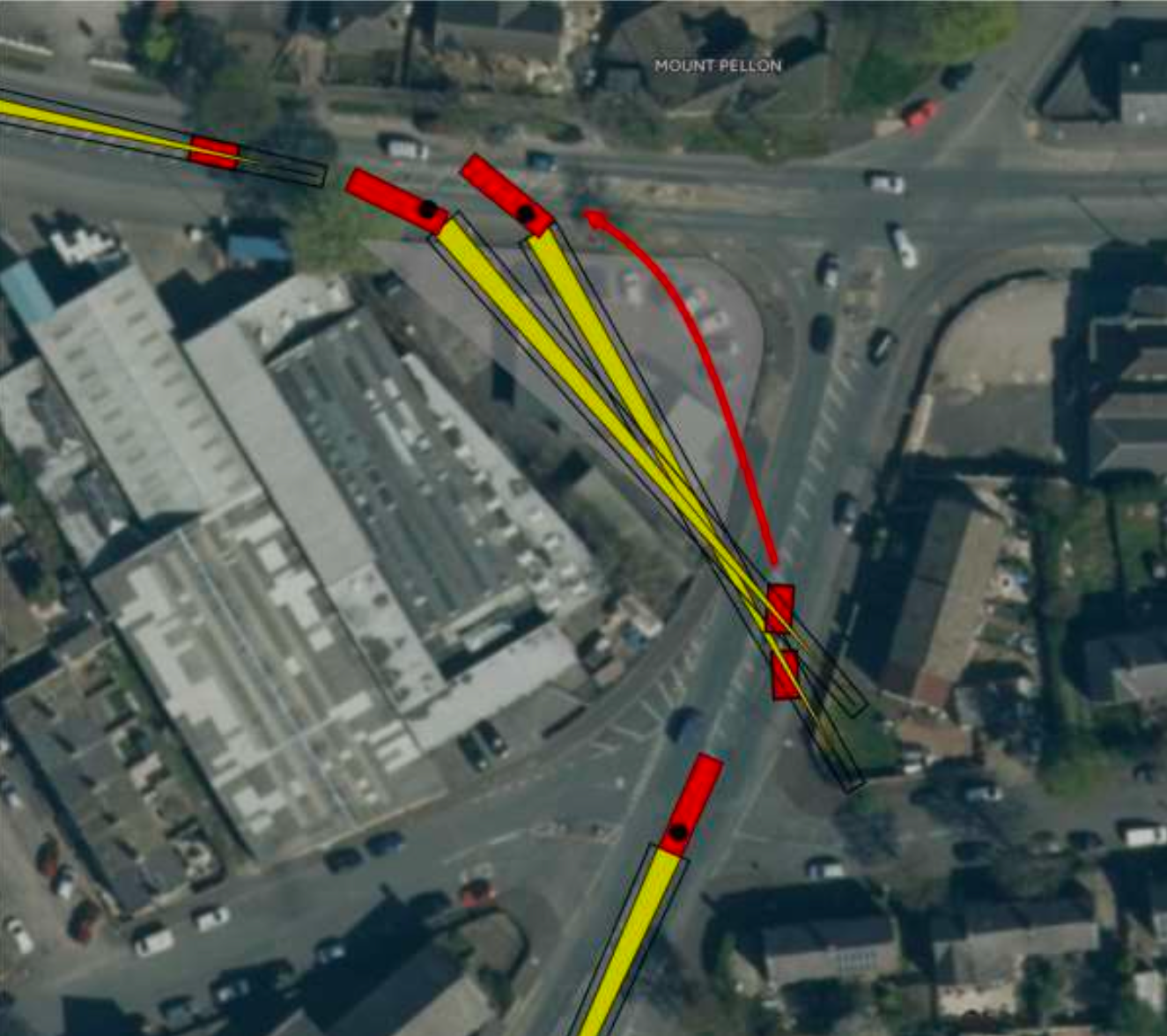
Swept path showing dolly path and demolished building | Diagram: WTRG
Now Moor End Rd is wide, and the route would go easily through Mount Pellon, Mount Tabor and Wainstalls, provided the residents can be persuaded to park on the downhill side. If not, the pedestrian islands down the middle of the road would have to be removed so that the convoy can pass down the middle of the parked cars at night.
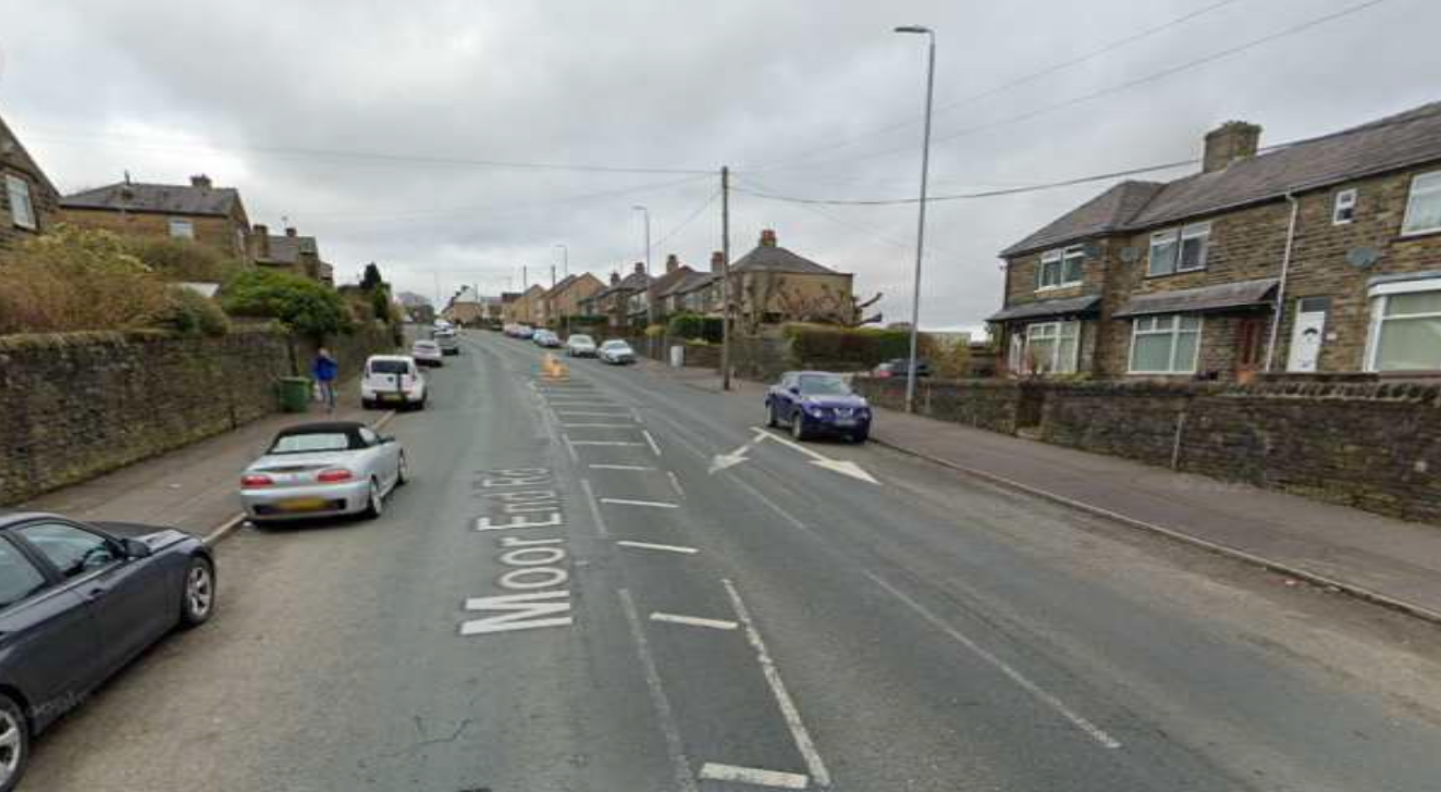
Either the cars on the left or the pedestrian refuges must be removed | Photo: Streetview
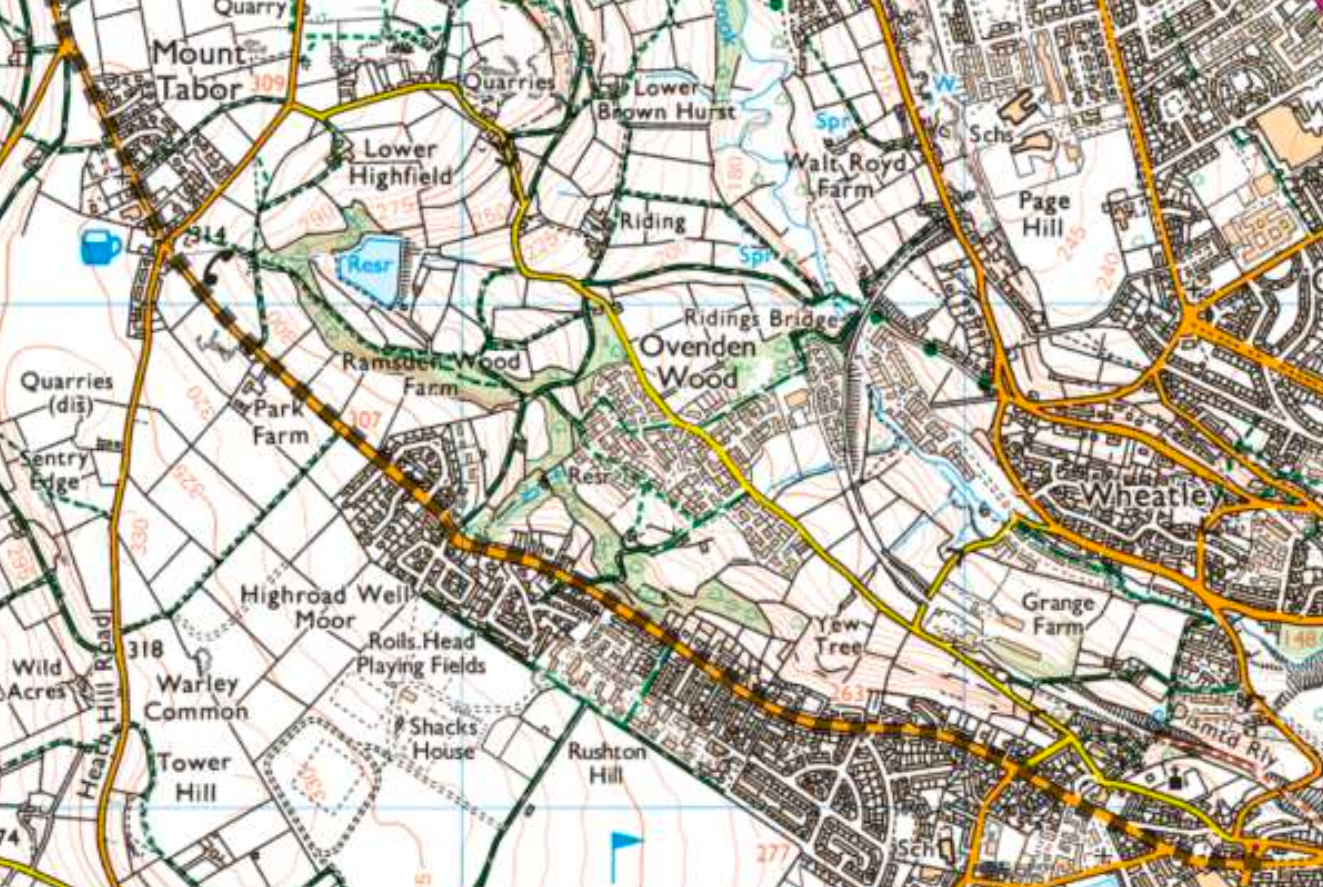
The route through Mount Pellon and Mount Tabor | Map: WTRG
Apart from parked cars, the route is straightforward through Mount Tabor and past Wainstalls.
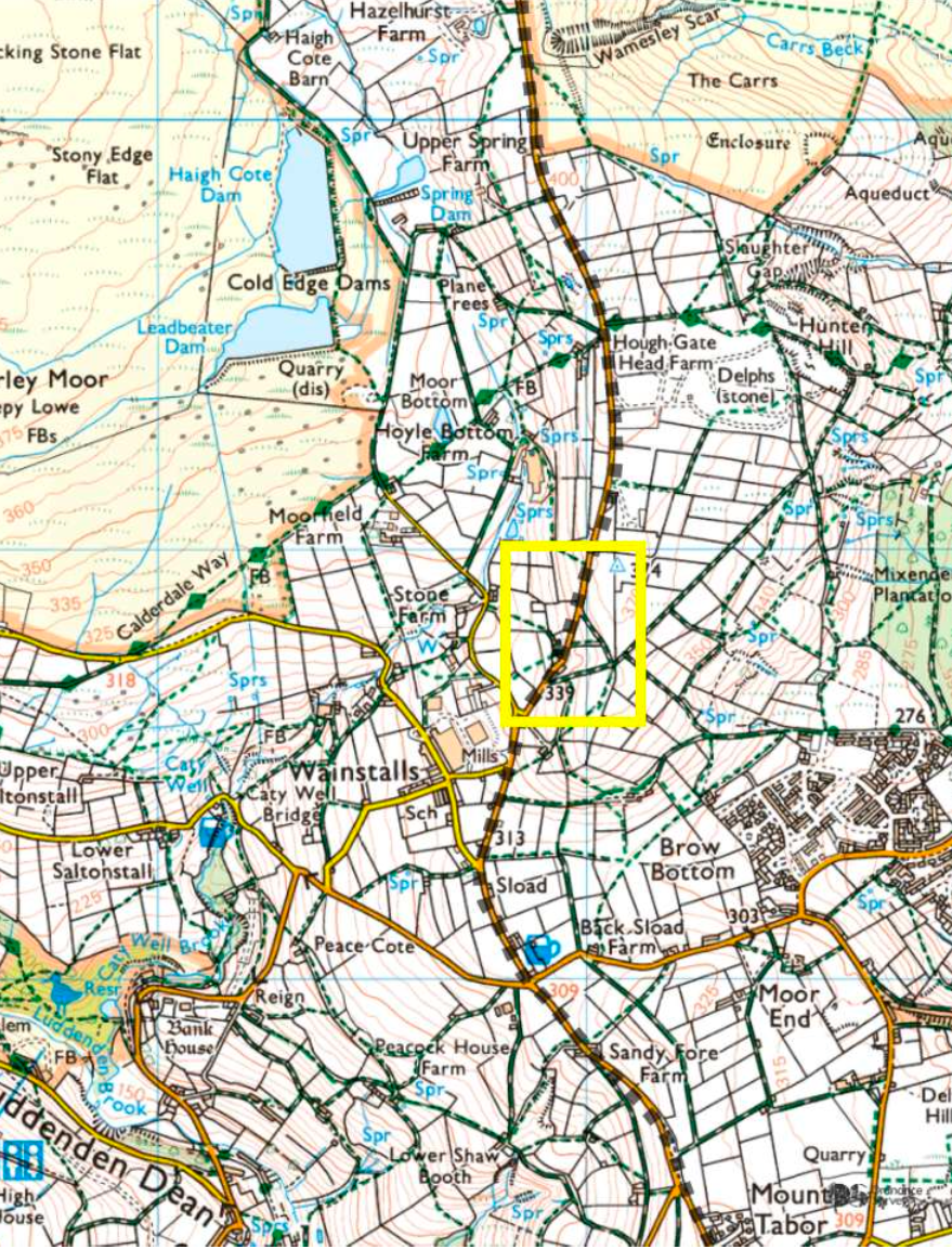
Mount Tabor to Cold Edge has a major difficulty | Map: WTRG
There is then a major difficulty passing Dale View Farm which is right on the road.
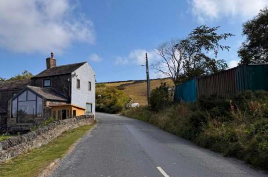
Dale View Farm with barn and bank on the right | Photo: WTRG
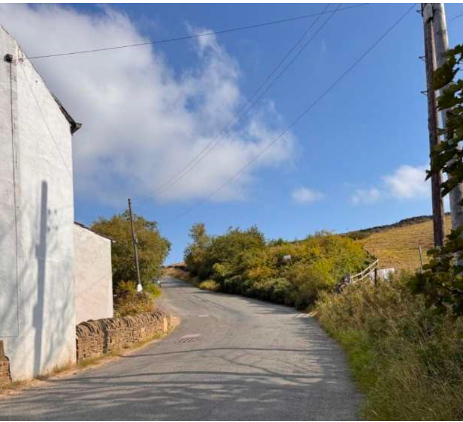
The bank must be cut away to allow the blades to pass | Photo: WTRG
The blade cannot pass here without an excavation of the bank on the right. Looking back down the road towards Wainstalls shows the difficulty of getting past this house with 80 metre blades travelling flat.
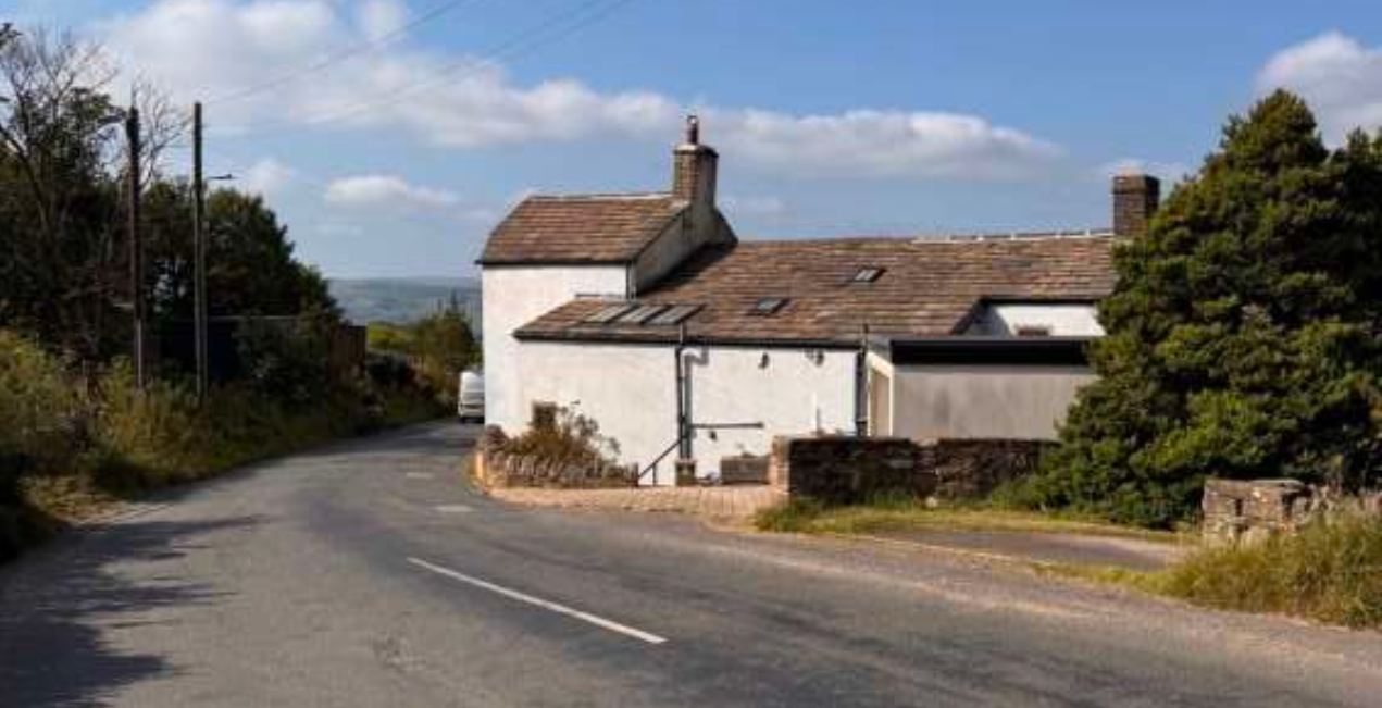
Looking back towards Wainstalls at the pinchpoint | Photo: WTRG
The excavation required is shaded in the swept path diagram below. This can be avoided if raised blades are used. The telephone wires would be rerouted.
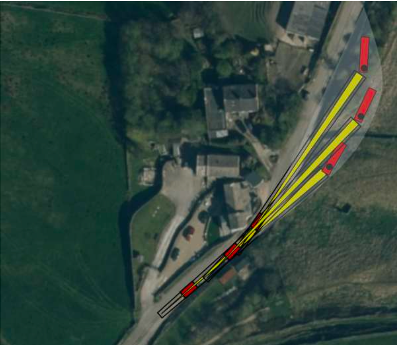
Swept path diagram shows excavation at Dale View Farm | Diagram WTRG
Now Cold Edge Road continues past the entance to Ovenden Moor WF whose blades are only 40 metres long, and passed easily up the route we have followed so far.
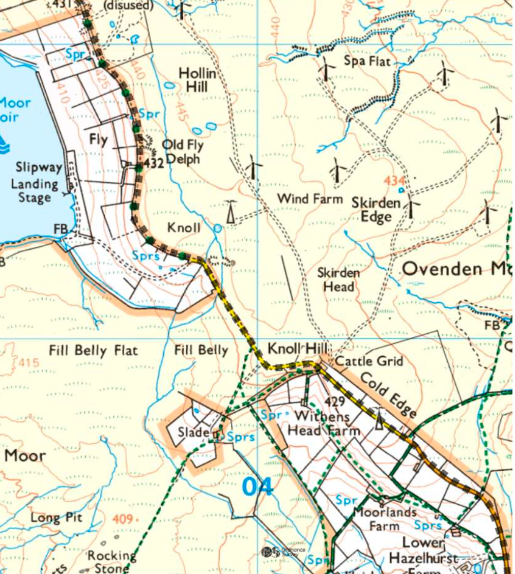
Option A passes the entrance to Ovenden Moor WF | Map: WTRG
Cold Edge Rd contines at various widths and it is all easy enough, if expensive, to widen to 4.5-5 metres, until we pass the north end of Warley Reservoir.
We come to the last map where CWF Ltd have set out three options.
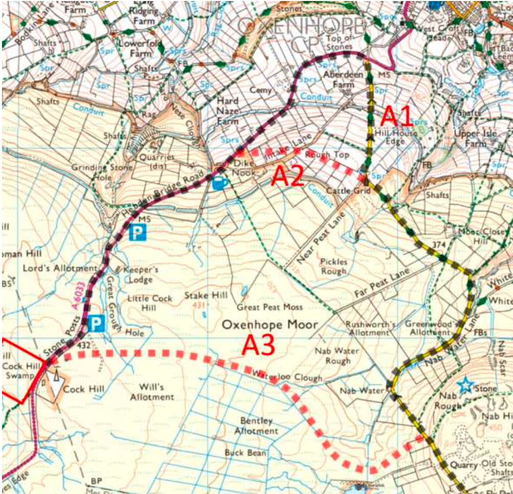
Option A might reach the A6033 in three ways | Map: WTRG
Option A3 avoids the difficulties still to come by going across Oxenhope Moor.
Restoration of the moor has begun by the Yorkshire Peat Partnership, financed by Yorkshire Water, public bodies and charities. A3 goes across deep peat and it would be an insult to the work done to rewet Oxenhope Moor. A3 would act as a peat drain and cause Oxenhope Moor to dry out again. Rewetting our peatlands is the cheapest action we can take against the tipping point in climate change when the peat and trees at our latitude begin to burn, causing a feedback loop in CO2. A wind farm on Walshaw Moor would do little to mitigate climate change and may make it worse. We should lead the world by rewetting Walshaw Moor and Oxenhope Moor, not drying them out with wind farm infrastructure on peat.The A3 track goes towards the end of Warley Reservoir before curling up to the plateau below Stake Hill and directly to the Cock Hill mast.
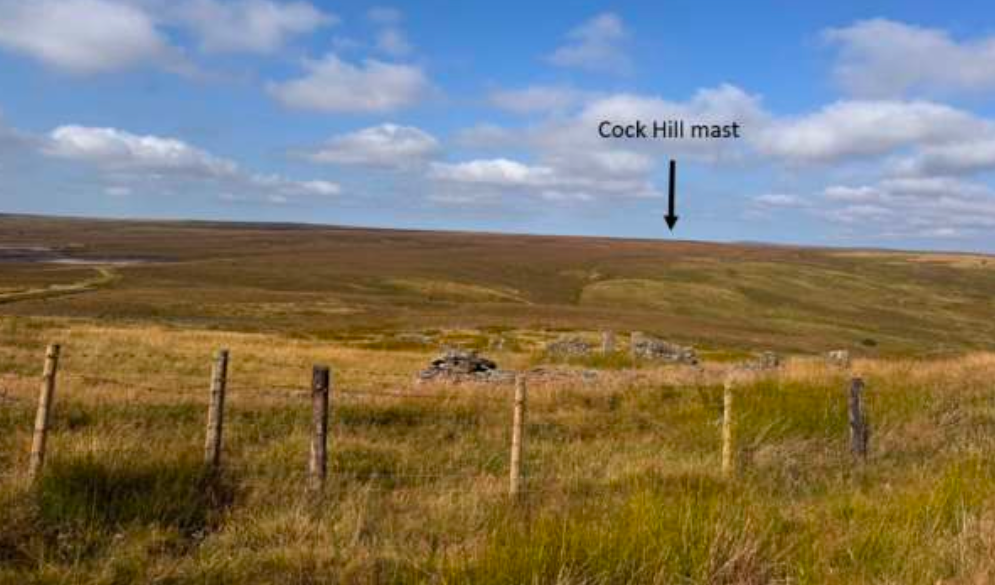
Option A1 crosses Oxenhope Moor to Cock Hill | Photo: WTRG
The next photo shows Ovenden Moor WF, the blue tip of Warley Reservoir and the cairn on Stake Hill.
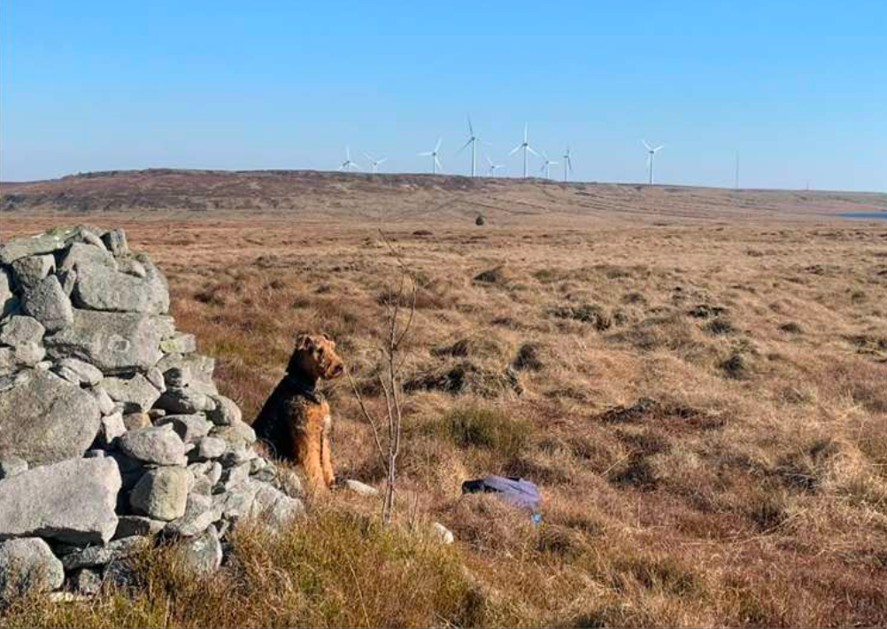
A3 passes below Stake Hill on deep peat | Photo: WTRG
The alternatives A1 and A2 go down the tight cloughside of Nab Water.
Widening here may have to go well to the right. The fencing is to stop fly tipping which is endemic in this area.
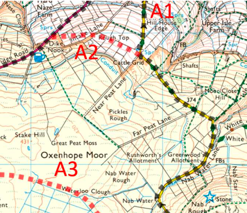

A1 and A2 go down Nab Water Lane | Photo: Streetview
The road climbs up again, and crosses Paul Clough just before the Oxenhope mast. The embankment over the clough would have to be widened by 50%.

The track and embankment must be widened by 50% | Photo: WTRG
The road carries on steeply down to the A6033. This road is the first to close each winter. The alternative A2 cuts right at the mast and traverses farmland below the level of the YW conduit.

Oxenhope Mast at the fork of A2 and A3 | Photo: WTRG
We have seen that if the blades are to travel flat, important trees would be felled at one end of Spring Hall Lane; a building would be demolished at theother end; and a substantial excavation would be needed to get past Dale View Farm.
The alternative to these destructive and expensive civil works is to raise the blades. The only comparable UK delivery using raised blades was to Pines Burn WF where Colletts of Halifax raised 65-metre blades through Hawick at 3 mph.
The delivery often had to be postponed because the wind was above 25 mph. Coordinating the police escort then became complex because the delivery date was often unsure. The wind is not less in Halifax than in Hawick, and the blades would be 15 metres longer and even more exposed. The problems in Hawick are well-documented.
If raised blades are used in Option A then there must be a transition between the M62 and built-up Halifax. A substantial lay-by is needed for the transfer by crane, and it is not obvious where this would be.
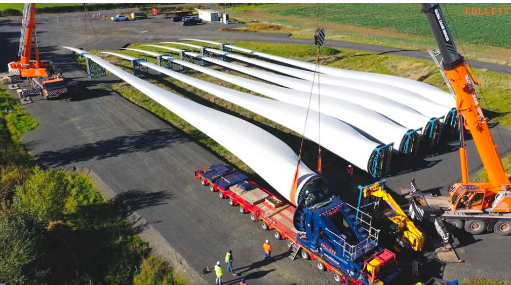
Layby for transition from a flat trailer to blade raising | Photo: Collett
Option A without raised blades involves the felling of excellent street trees and a track through a park and community orchard; the demolition of a car dealership and a substantial excavation around Dale View Farm.
With raised blades the destruction would be avoided, but a transition layby must be made and Halifax would endure the problems of Hawick, but for much longer, because there are four times as many blades and they have much more windage. The delivery might be a decade away, by which time raised blade deliveries with 80-metre blades might have become more common.
By Walshaw Turbines Research Group

The image above envisions how the site will appear from Cock Hill on Oxenhope Moor.
How You Can Help
GETTING INVOLVED
Speak Out
Share your thoughts with your communities at home and online. Attend meetings.
Contact a member of the House of Lords.
Write to the Secretary of State for Energy Security and Net Zero, (currently Ed Miliband), Secretary.State@energysecurity.gov.uk and tell them that there is no need to build wind farms on protected peatland.
Stronger Together
You are welcome to join our campaign group and add your voice and vote to the many – The Calderdale Windfarm Action Group is the main Facebook group representing all of the eight campaign groups of Stronger Together to Stop Calderdale Windfarm.
We’d love to have you on board with us.


Media Enquiries
For interviews and press/media enquiries please contact:
Lydia MacKinnon - 07766 333114
Penny Price - 07771 737274


